Desigualdades, Integración, Globalización
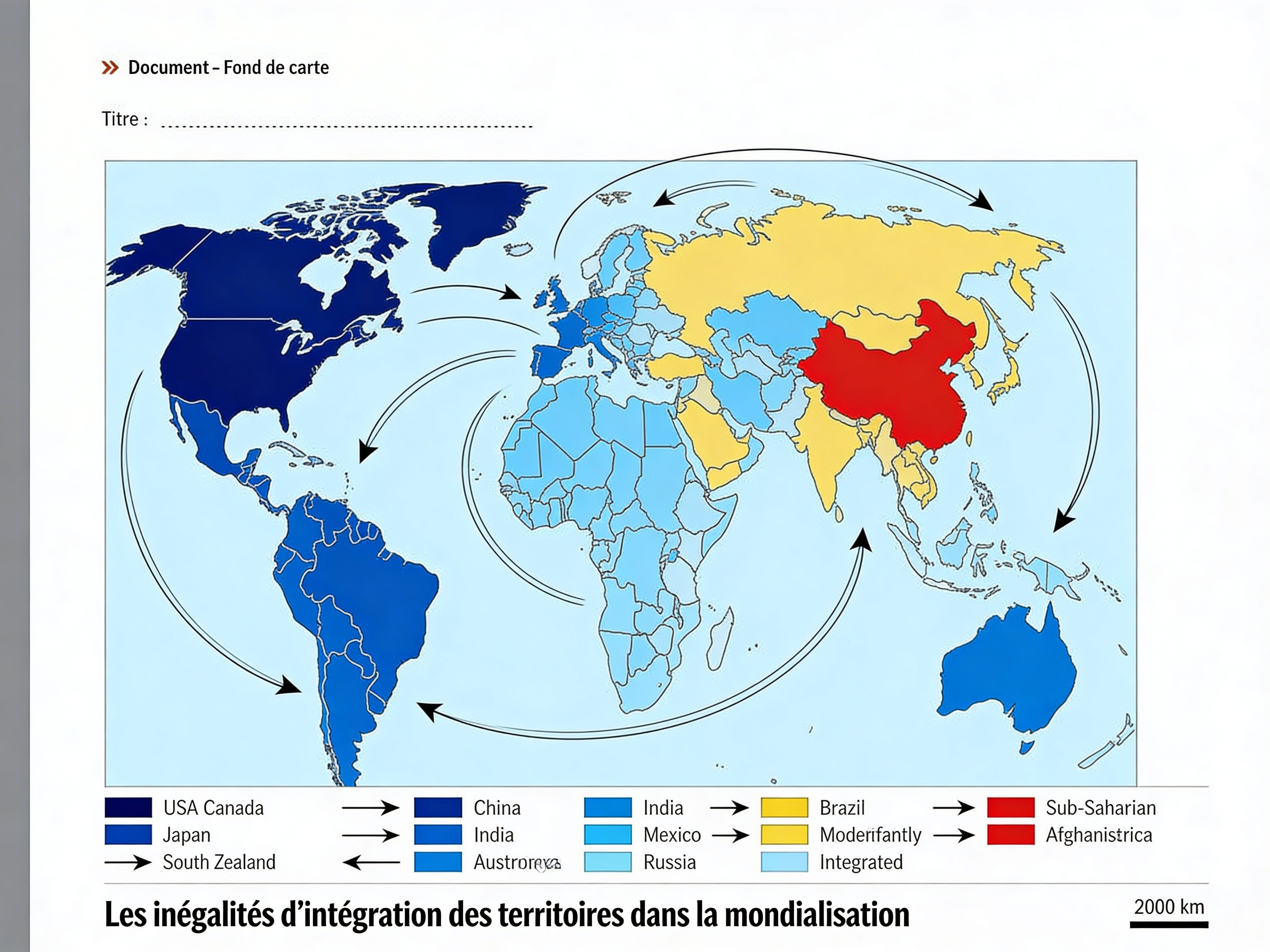
Transform this blank world map into a geography sketch (croquis) illustrating 'Les inégalités d’intégration des territoires dans la mondialisation'. Use colors to differentiate levels of integration: dark blue for highly integrated territories (Western Europe, USA, Canada, Japan, South Korea, Australia, New Zealand), medium blue for emerging economies (China, India, Brazil, Mexico, South Africa, Russia), light blue or yellow for moderately integrated, red for weakly integrated (Sub-Saharan Africa, Afghanistan, parts of Central America). Add curved arrows showing main economic flows (trade, investments) from core to periphery. Include an organized legend at the bottom with color key, arrow meanings, and title 'Les inégalités d’intégration des territoires dans la mondialisation'. Keep original country borders visible in light lines. High school exam style, clear and precise.
Más como esto